


Chart of the Atlantic Ocean — Antique Nautical Chart Print
Chart of the Atlantic Ocean — Antique Nautical Chart Print
Couldn't load pickup availability
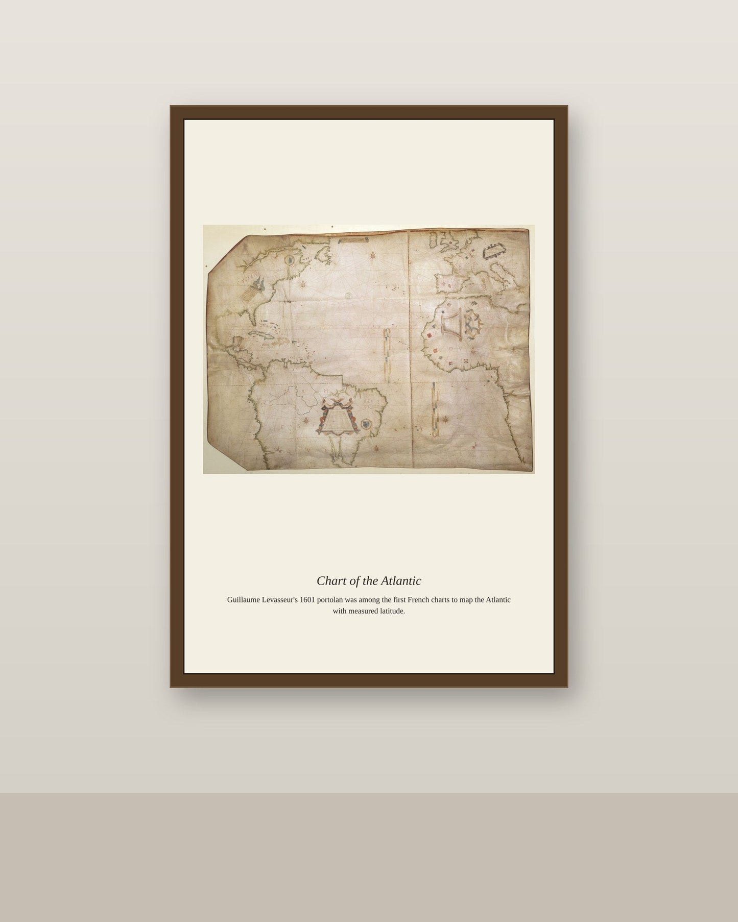
This chart of the Atlantic reflects the accumulated labor of generations of naval hydrographers who systematically resurveyed the ocean's coastlines, depths, and currents as scientific standards of accuracy improved through the 18th and 19th centuries. Where earlier charts relied heavily on estimation and secondhand report, later Atlantic charts incorporated triangulated coastal surveys and depth soundings taken by dedicated survey vessels, producing maps precise enough to support the enormous growth in transatlantic shipping, immigration, and eventually telegraph cable-laying across the ocean floor. Each chart represents a snapshot of how well humanity understood one of the world's most consequential bodies of water at a given moment.
Materials & origin
- Material: 200 gsm gallery-grade, acid-free fine-art paper (FSC-certified).
- Print: Archival giclée, 12-colour printing, smooth matte finish for glare-free display.
- Artwork: Restored from a public-domain original; colour and detail digitally cleaned for large-format print.
- Origin: Made on demand and shipped from the print hub nearest you, cutting transit and waste.
- Framing: Sold unframed; ships rolled in a protective tube.
Share


As Featured In





This is genuinely one of the nicest things we own now. It has made me appreciate Chart of the Atlantic Ocean more than I already did. The color accuracy is the best I have seen from an online order. ✨
This went well past what I expected. It has made me appreciate Chart of the Atlantic Ocean more than I already did.
Thank you for coming back for another one. Repeat customers are the best compliment we get.
It arrived four days after I ordered and in perfect shape. It captures Chart of the Atlantic Ocean well enough that I stopped looking for a better one.
Everything about this went better than I hoped. I have been hunting for a good version of Chart of the Atlantic Ocean for two years.