


Mediterranean BlackSea Portolan — Antique Nautical Chart Print
Mediterranean BlackSea Portolan — Antique Nautical Chart Print
Couldn't load pickup availability
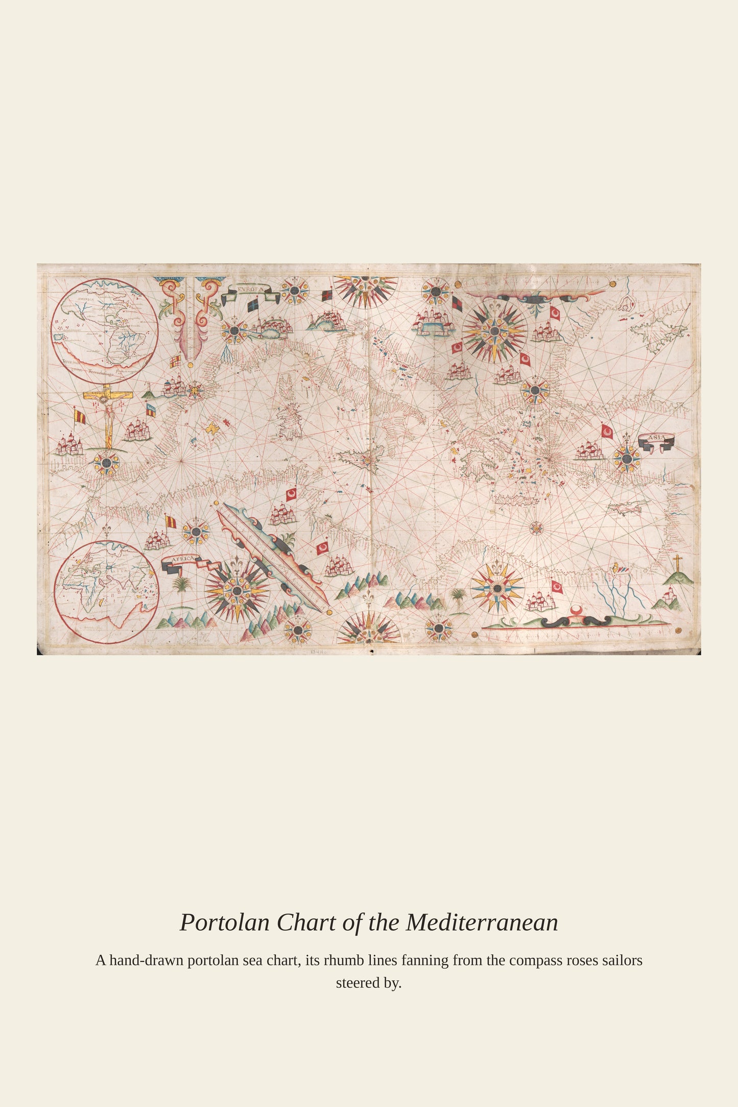
Charts covering both the Mediterranean and Black Sea together reflect the tight commercial relationship between the two bodies of water, linked by the narrow straits of the Dardanelles and Bosphorus that funneled all shipping between them through Constantinople. Venetian and Genoese merchants held trading colonies on the Black Sea's shores for centuries, exporting grain, furs, and slaves from the Crimea and the Caucasus back through the straits to the wider Mediterranean world. A combined chart of both seas let a captain plan an entire eastern Mediterranean voyage on a single sheet, tracking the full length of a trade route that could stretch from Venice to the far shores of the Black Sea.
Materials & origin
- Material: 200 gsm gallery-grade, acid-free fine-art paper (FSC-certified).
- Print: Archival giclée, 12-colour printing, smooth matte finish for glare-free display.
- Artwork: Restored from a public-domain original; colour and detail digitally cleaned for large-format print.
- Origin: Made on demand and shipped from the print hub nearest you, cutting transit and waste.
- Framing: Sold unframed; ships rolled in a protective tube.
Share


As Featured In





The detail is unbelievable for the price. It has made me appreciate Mediterranean BlackSea Portolan more than I already did.
It looks like something out of a museum shop, in the best possible way. The detail in Mediterranean BlackSea Portolan holds up with my face inches away. The value here is so good that I keep expecting to find the catch. It has been worth every minute of the wait.
I ordered it on a Friday and it was here Monday. The tones across Mediterranean BlackSea Portolan are even and true right to the corners.
My mother liked hers so much that I ordered one too. The colors in Mediterranean BlackSea Portolan are richer than any version I found online. It has made every other thing in that room look better by association. I could not be happier with it.